

The current conflict is rewriting the narrative surrounding unmanned vehicles, particularly drones. Historically viewed as hobbyist tools or photography gadgets, the role of drones has dramatically evolved. Today, they are essential components of national preparedness and resilience, highlighting a significant shift in how we perceive and utilize this technology. The pressing challenge lies not just in deploying drones, but in managing them autonomously and safely in densely populated areas without real-time human intervention.
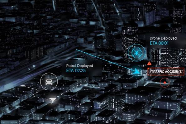
As multiple emergency situations arise across various locations, the conventional model of “one pilot per drone” becomes increasingly ineffective. During crises, it is imperative for local authorities and rescue services to have immediate situational awareness. Consider the emerging missile threat from countries like Iran; the focus must not only be on the effectiveness of interceptors but also on understanding what is happening on the ground at the moment of impact. The ability to deploy an autonomous array of drones within a mere 15 seconds from urban docking stations provides decision-makers with crucial live information prior to the arrival of security forces on the scene.
The Architectural Revolution
To navigate this complex landscape, a significant technological transformation is needed: adopting the Drone as a First Responder (DFR) model. This approach fundamentally changes our understanding of drones; instead of being mere support tools, drones become the first line of defense during emergencies. In this model, drones stationed at critical points are deployed automatically upon receiving alerts from the command center.
This shift effectively eliminates the “fog of urban war.” Drones can reach an impact site quicker than many traditional emergency services, capable of streaming vital information regarding damage and resource allocation. Operated autonomously, these drones evolve from simple observation tools into intelligent edge sensors equipped with Artificial Intelligence. During their flights, they conduct real-time data analysis, producing a dynamic situational overview without endangering human operators who might be at risk from missile threats or other hazards. Municipalities like Holon and Modi’in have already reaped the benefits of this technology, being the first to document missile impact sites in real time, thus allowing for more effective evacuation management.

The Numbers Behind the Surge
Data reflects a burgeoning trend in drone technology. Recent studies forecast an annual growth rate exceeding 15% in the fields of aerial autonomy and DFR solutions, propelled by the increasing demand for urban resilience. Research from the U.S. Federal Aviation Administration (FAA) and various international emergency agencies highlights that employing autonomous drone swarms can reduce the time needed for damage assessment and casualty location by anywhere from 30% to 50% compared to traditional methods.
Notable implementations around the globe showcase the potential of these technologies. In China, autonomous drone networks optimize traffic management and hazard identification in smart city environments. Brazil employs drones as first responders to swiftly identify accidents on highways, leading to improved safety measures and reduced evacuation times. In the United States, DFR programs have demonstrated that drones typically arrive at incident sites within two minutes, offering critical information to law enforcement long before they physically arrive.
Israel as a Global Field Lab
Israel stands poised to be a pioneer in the global drone market, not only in the manufacturing realm but also in developing the sophisticated AI systems that govern these unmanned vehicles. The country’s unique operational background gives it an edge, capable of navigating challenges such as electronic GPS jamming and harsh weather, all while adhering to stringent aviation regulations. Following successful deployments in Holon, several other cities are now training and managing their independent drone fleets, enabling mayors to exercise control remotely with unmatched ease.
Initiatives like Israel’s “National Drone Initiative” have already validated the delivery of critical medical supplies and the protection of essential infrastructure through a well-coordinated aerial network. As local authorities invest in systems designed to create a “civilian aerial dome” for border area security, it becomes clear that autonomous drones serve as both strategic and financial amplifiers. They reduce the necessity of costly ground patrols and deliver a rapid response capability that physical barriers alone cannot provide.
From Technological Courage to Regulatory Courage
For the vision of fully autonomous drone operations to materialize as a national standard, it’s crucial to expedite the formulation of regulations that facilitate large-scale autonomous flights over populated areas. The technology is available and has demonstrated its efficacy in real-world situations, and now it requires the resolve to incorporate autonomy into our broader urban and national security strategies.
In an era where threats are constantly evolving and emerging from the air, it stands to reason that our responses must also evolve—smarter, faster, and fully autonomous. The airspace above Israel’s urban centers needs to become a meticulously managed digital corridor, fostering innovation while simultaneously ensuring public safety and security.
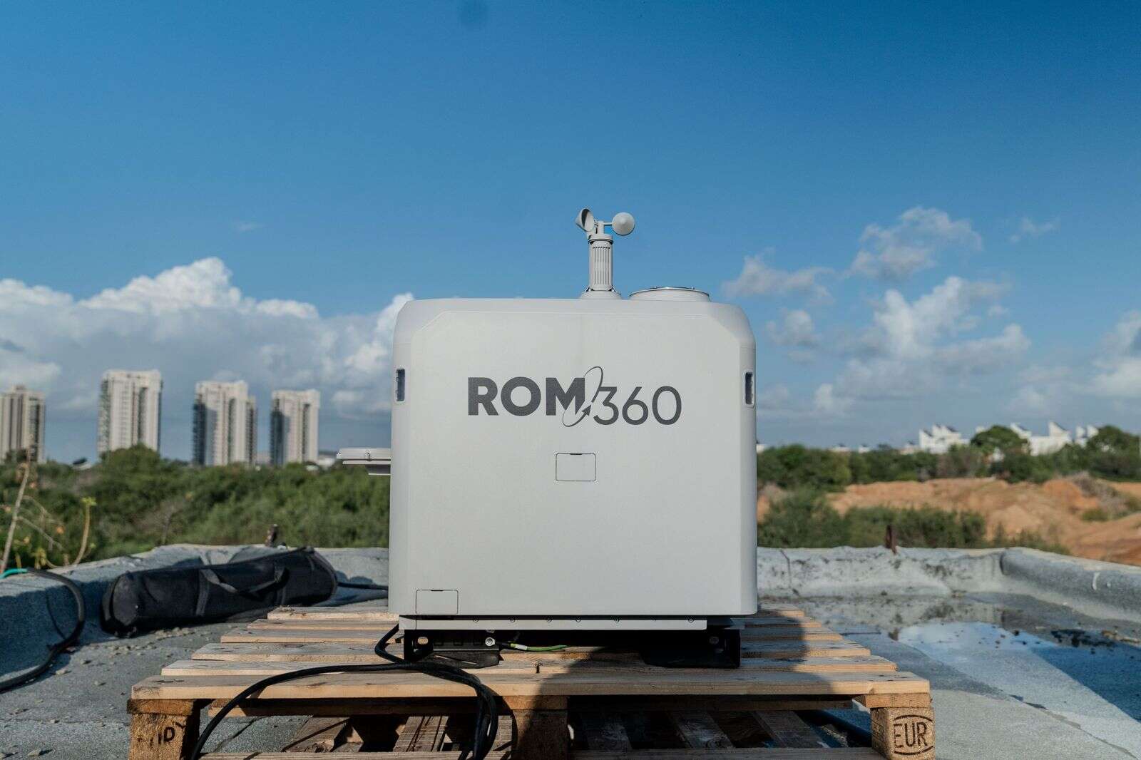
Yoely Or is the Founder and CEO of Cando and heads the ROM360 array in collaboration with the global company High Lander.